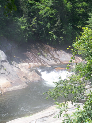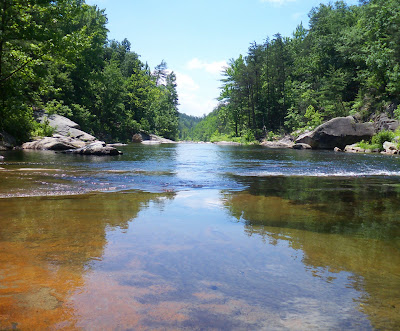


...to bring you these :)
The Story:
We set out on a normal
weekend road trip for us,
thinking we would head to
Pisgah National Forest (N.C.)
to explore and to photograph.
On our way down, we could
see the Blue Ridge Parkway
as it stands currently,
alive with all its greenery
and with light (bottom.)
What a truly beautiful
and a lush day it was.
Our entryway into the
Pisgah National Forest
was preceded by a LONG
drive down, a 7 percent
grade down over only 11 miles;
steep and swervy driving at its best.
Drivers and the motorcycles
alike were out everywhere
touring this highway in the
sun and the balmy, warm
temperature of 72 degrees.
We entered the Wilson Creek Gorge
area off Brown Mountain Beach Road.
Wilson Gorge is located off this road well
into the forest along a wide gravel
road that goes on for miles, with the
gorge and swimming/entry areas to the left.
To obtain photos of the creek and gorge
it requires a hike down rocks that are
the steps and over tree roots.
The angle of descent is rather steep.
What We Didn't Know:
To get OUT of the gorge it would
have been wisest (--truly--) and easiest
to turn around taking a navigable
gravel highway out onto paved roads.
However, thinking there was (eventually)
paved road ahead (God- I love those words...)
we continued inward toward the
--very-- small and highly secluded town of
Mortimer. THIS was a gravel road that went on
for MILES. What I want to ask you here is this....
Have you ever reached the 'point of no return?'
Well~~ this surely, is what we were well
afflicted with. We continued further inward
into the forest via said gravel road. Now,
my story takes an even stranger turn.
Upon becoming a wee frightened (or almost
disoriented although my husband would
never admit to this :) ) and really downright
unsure that we would EVER get out
(of the forest...off the gravel...
out of the mountains...back to some
semblance of mini-civilization!!!) ....
my husband MET the mayor and
the sheriff on the front porch of the local
VERY SMALL mercantile when asking for directions.
"Can you tell us which way is the safest
and the fastest way out??"
WELL. Let me tell you....
They both assured us and directed us
to take --the road to the LEFT--
All I can say is...thank God (Did I say that??!)
I said that because we later
found out when researching
and googling detailed maps of the
Pisgah...the ---other way---
(the road to the RIGHT) was
a 2000 foot climb over 4 miles on bad gravel
--and narrow...( which we came alarmingly
close to taking; we 'would have' had to
-come back down- as our vehicle
could not possibly have navigated it...)
Did I tell you that when you are reading maps
of this area ...that one cannot discern gravel
roads from the paved???
And that the map doesn't discern
when they go from gravel to paved
then back to gravel????
I have to say they actually call
roads roads that, well---I would not
deem fit to be called as such!
Back to our story.
We took the road to the left thinking
at some point--surely; we would reach paved road.
Boy, were we wrong. I cannot aptly
nor fully describe what we endured.
What I can say is this: we will never,
never, never take this road
( just the name 'Roseboro Road'
(?? road really!??)
makes me now--still--shiver...)
It was lonely; very steep at times,
it went from O.K. gravel to
what I would call small bolder-like
ROCKS (or tough bad nasty gravel.)
There was no power (electric.)
And no cell service (I can endure this)
at all; not a lick (for many many miles up.)
Can I say it was well; rather bumpy?
How 'bout jaw rattling? It made me nervous
(and I consider myself an adventurer of sorts.)
All in all were not really sure
-where we were- nor
how we actually and finally
got back on the Blue Ridge Parkway
( that is near where I kissed
the very ground to be home!)
But we DID
climb
between 3 and 4000 feet
on gravel roads
(and bad gravel at that.)
Signs we saw along the way:
1. Road narrows ahead
2. No horses in the recreation area
3. 26 MPH


Oh no! Now that is scary stuff! I'm so glad you got out safely. It's funny how something light and fun and sunshine-y can turn all scary, isn't it? But the photos are beautiful, lg. And I'm thinking that your adventure will become one of those funny stories you and your husband share with others. Thank heavens that distance lends that nice touch of humor :)
ReplyDeleteI'm still shell shocked. :-) Great pics though and we will take our teens back to swim where the photos of the water are. We NOW know to turn around-though. My GOD.
ReplyDeleteI'm so glad you made it out safely. I had a similar experience in western North Carolina once when some friends and I were exploring and ended up on a mountain hugging road. I was driving and didn't dare look down. My heart pounds just thinking about it still. We encountered some road workers who called out, "You're lost!" No kidding.
ReplyDeleteI love that your husband got directions from the mayor and that they were good ones.
Lovely shots and thank you for that, in spite of the danger.
Edited to add:
ReplyDeleteSigns we saw along the way:
1. Road narrows ahead
2. No horses in the recreation area
3. 26 MPH
ha!
lg
:)